
In the 16th century, the Spanish Crown was one of the great global powers and was surrounded by enemies on all sides, most notably the French Crown and the Barbary pirates who had their bases on the North African coast. In 1535, King Charles I (1500–1558) passed through Roses and, aware of its strategic importance, a few years later (1543), he commissioned the construction of a set of defences intended to protect the bay. This defence included the construction of a group of surveillance towers to control the coast, but the two main elements were the construction of a small castle (Trinity Castle ) in the northern area, and a large fortress around the town that, together, were meant to close and defend the bay. The main objective of the fortress—traditionally known as the Citadel or “the Walls” by the residents of Roses—was the defence of the port. The defence was completed with the fortification of the Medas islands.
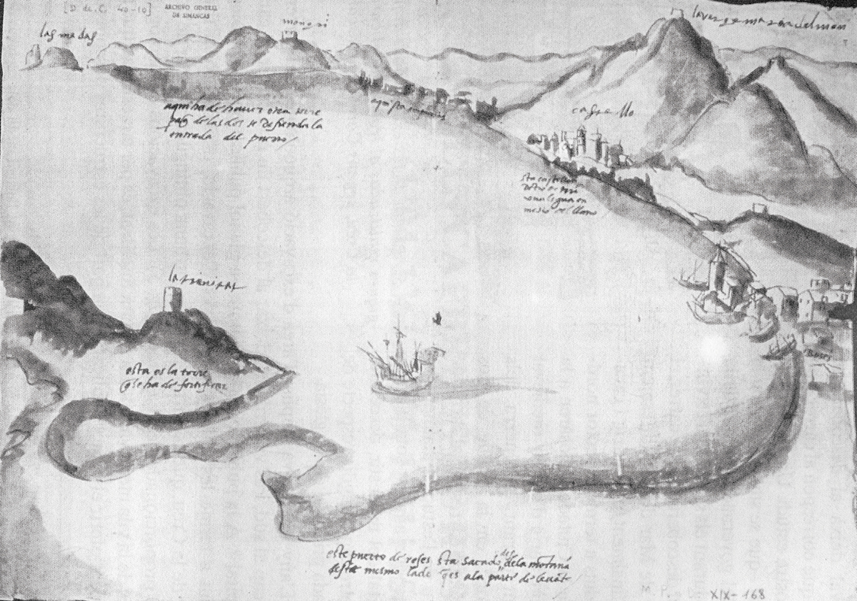
Source: Biblioteca Virtual Defensa.
The construction of the Citadel suffered different problems, and the project was subject to different modifications. The first project, carried out by the military engineer and Captain General of Artillery, Luís Pizaño (c.1480–1550), was rejected, as its design was not practical. Afterwards, the lack of financing—since money was being invested in the construction of the Trinity Castle at that time—led him to design a second, much more modest project. This consisted, basically, of reinforcing the town’s walls, with the addition of bastions (large platforms intended for artillery).
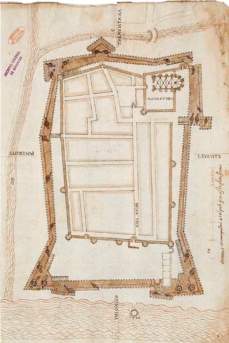
Source: Biblioteca Virtual Defensa.
Upon Pizaño’s death and with the economic problems solved, his replacement, the engineer Gian Battista Calvi (?-1580), was able to design and build a fortress with a five-sided (pentagonal) layout that, with some renovations, is the one we can visit today.
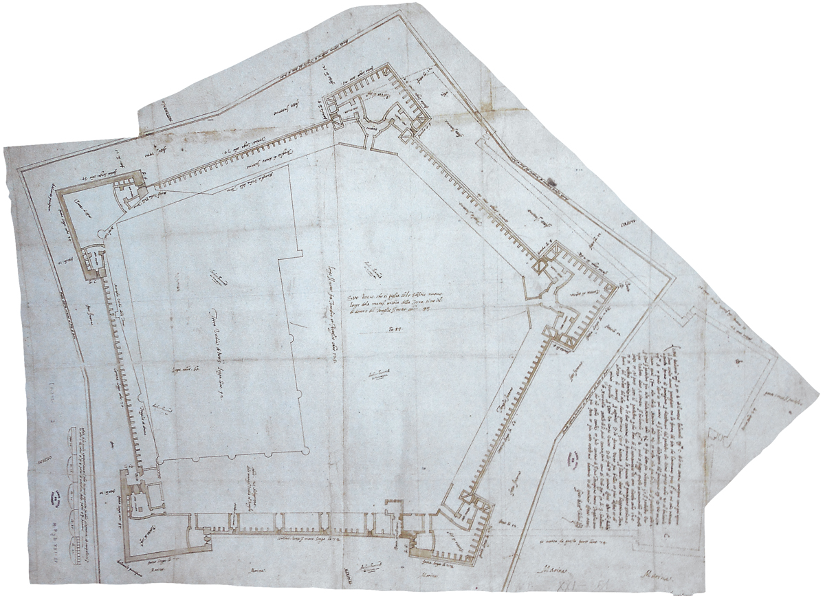
Source: Biblioteca Virtual Defensa.
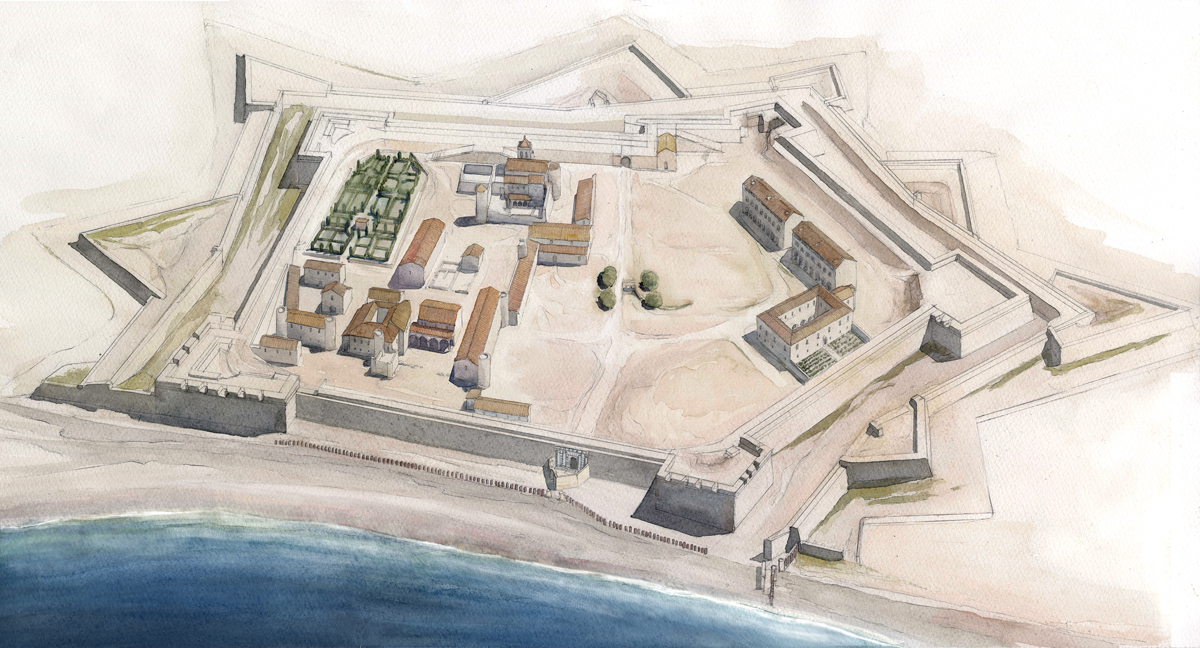
The new fortress presented some problems. The internal structuring in newly constructed fortresses was usually planned with a central space (the parade ground) from which streets were distributed like the spokes of a wheel, which allowed for a quick deployment of the troops towards the walls and bastions, known as a radiocentric plan.
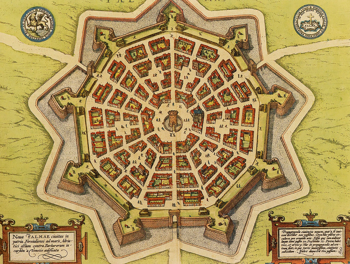
Source: Wikimedia Commons.
This model could not be applied in Roses. The town occupied the entire western half of the fortress, hindering the circulation of troops towards this area, while the eastern half, apparently empty of constructions, was owned by the monastery. Initially, the monastery did not want military buildings in this space because it believed that with the new walls, the town would grow in population, and this space would end up being used for new houses and businesses. This was not the case; on the contrary, Roses lost part of its population. Finally, at the end of the 16th century, construction began in this area, with the building of two barracks for the infantry (File 4), some warehouses, and later, a hospital (File 2).
Despite the difficulties, an attempt to reproduce this radiocentric plan can be seen in the arrangement of the different buildings that occupy the eastern area of the fortress. On the west side, a set of large warehouses were built supported against the old medieval walls, while, when it was finally possible to construct buildings at the eastern end, these followed the perimeter marked by the defences, always leaving a large central space as a parade ground and empty spaces between the buildings to facilitate access to the walls. The central area even featured a monumental fountain and an avenue with trees that connected the two gates of the fortress (the Land Gate to the north (File 5), towards the interior, and the Sea Gate , to the south, opening directly to the port (File 0)).
Town and fortress—or, in other words, soldiers and civilians —coexisted for practically a century, during which time living together and carrying out daily activities must not have been easy, since the needs of the two groups were different. In fact, the documentation tells us about the existence of conflicts between the civil and military authorities. Thus, in 1599, the consuls of Roses (equivalent to the heads of the town council at the time) complained to King Philip II (1527–1598), among other issues, about having to house the troops in their homes, and that the fortress construction works had caused a depopulation of the town.
In the year 1645, the fortress was besieged and occupied by French troops within the framework of the War of the Reapers. The French occupation lasted fifteen years and marked a before and after in the history of Roses. The town was abandoned during the siege, and afterwards, a new urban nucleus was created to the northeast, outside the fortress, around the Riera de Ginjolers, which constituted the germ of the current population.
The definitive militarisation of the space then began. Most houses and other buildings were abandoned, and their walls quickly and forcefully dismantled to use the materials in new works or defences. Only some of the properties were reused and readapted to cover the needs of the troops. Something similar happened with the streets. Most of them, especially those oriented east to west, were abandoned, and in fact, in some parts they were covered with new buildings. Conversely, the latest excavations have shown that the streets on the east side (Major and Nou), oriented north to south, remained in use practically until the final moment of the fortress’s existence.
Source: J. Sagrera.
Regarding the old walls, a portion —the western section and part of the northern stretch —was integrated into the slopes of the new defences (a part is still visible on the west side of the fortress (File 20)). Of the rest, those sections that were used as part of new buildings were preserved standing, while others , like the houses, ended up demolished and plundered.
In the town area, the new layout was essentially organised around two main centres. On one side, some large gardens were built in the northwest corner (File 21). Around them, a set of constructions were arranged, especially on the east side where, between the gardens and the Carrer Major, a long building with various functions was built (File 12), ranging from housing some of the officers to production facilities, such as a flour mill (File 12). The other centre was organised around the governor’s house, a large building that occupied the southern area (Files 10 and 18).
Roses was the protagonist of many of the military conflicts that pitted the Spanish Crown against the French between the 17th and 19th centuries. The fortress was attacked many times and changed hands on different occasions. The last was the occupation by French troops during the Napoleonic era (1808–1814). When the French troops withdrew, they destroyed a large part of the defences, especially the bastions, and the fortress has remained practically abandoned ever since.
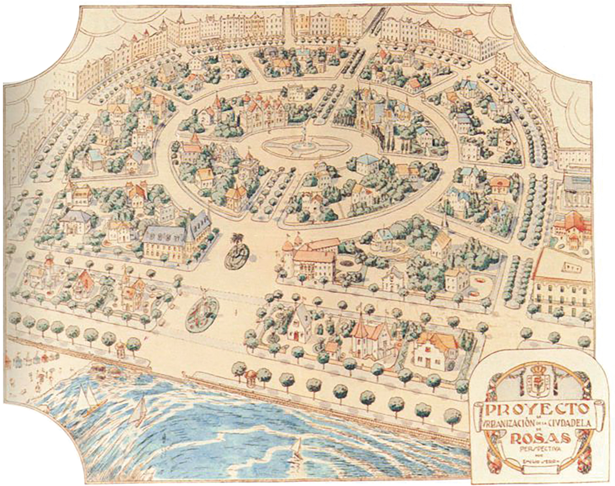
In the 20th century, different projects were drawn up aimed at creating an urban development on the site of the Citadel . With this objective, part of the south and east walls were demolished, as well as the Santa María bastion (located in the southeast corner), until, in 1961, the monument was declared an Asset of National Interest and protected from any speculation or destruction.
Source: Arxiu Municipal Roses.
|
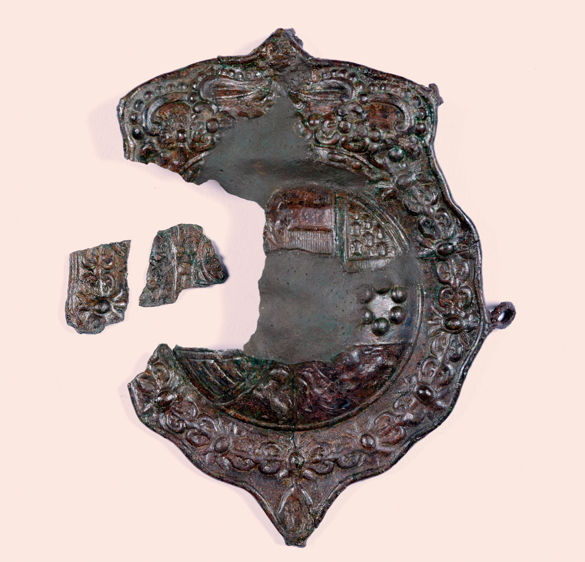
The Military Garrison Archaeological excavations have made it possible to recover many elements belonging to the troops that were housed in the Citadel over time. From uniform elements, such as buttons, often bearing the name of the regiment, to weapons or ammunition. Some of the best-preserved pieces can be seen in the Citadel exhibition hall.
|
For further reading
Bouzas, M., & Palahí, Ll. (2024). La circulación monetaria en época moderna en un espacio militarizado. El caso de la Ciutadella de Roses. Archeologia Post‑Medievale, 28, 327–361.
Burch, J., & Palahí, Ll. (cur.) (2020). La Ciutadella com a espai urbà. Guies del Patrimoni Cultural de Roses, 3.
Burch, J., & Palahí, Ll. (cur.) (2021). La Ciutadella com a espai militar. Les defenses. Guies del Patrimoni Cultural de Roses, 4. Girona: Documenta Universitaria. https://www.documentauniversitaria.media/omp/index.php/crapa/catalog/series/guies
De la Fuente, P. (1998). Les fortificacions reials del golf de Roses en l’època moderna. Papers de Recerca, 3. Roses.