
People already lived in the Roses area before the arrival of Greek colonists in the 4th century BCE, but we have practically no data about this occupation. It is possible that the population concentrated in the valleys and hills more or less close to the coast.
The Greeks were a trading people who, throughout their history, established colonies throughout the Mediterranean. Trade with local communities was usually the main objective. Colonies could initially have a relationship with the residents’ city of origin, but eventually, most of them ended up becoming independent cities. Although Roses had the best natural harbour in the area, the first Greeks did not settle here, but did so in Sant Martí d’Empúries. Although the natural conditions were, apparently, worse for building a harbour , that area was much closer to the large Iberian settlements, and there was already a series of routes and paths that facilitated establishing commercial relations towards the interior of the territory. Roses, on the other hand, occupied a more marginal space, with poorer agricultural land and greater difficulties in establishing good roads, since it is surrounded by marshes and mountains.
Traditionally, it is considered that the colony of Rhode was founded at the beginning of the 4th century BCE, when the great colony of Marseille (Massalia), in the south of France, wanted to create a trading point on the south side of the Pyrenees. However, not all researchers agree, and some believe that Rhode was born as a kind of “branch” or neighbourhood of the inhabitants of Empúries themselves. Whatever its origin, over time, as we will see, it became an independent colony.
The original settlement seems to have been concentrated on the small elevation known as the Santa María hill, a slightly elevated area that, unlike today, jutted out into the sea at that time. It was naturally protected by two streams, the Riera de la Trencada to the west and the Rec Fondo to the east.
The function of the colony was to act as a secondary post, either for Marseille or Empúries, and to facilitate commercial contact with the nearest territory, especially with the town of Peralada, located about eighteen kilometres away. Communication with the interior had to be carried out via old roads bordering the now-disappeared lake of Castelló, although the existence of a navigable route crossing the lake itself and following the Muga river, which was more abundant than it is today, cannot be ruled out. Cereals were probably the main product traded initially.
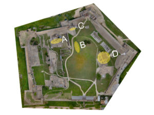
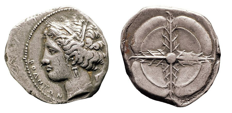
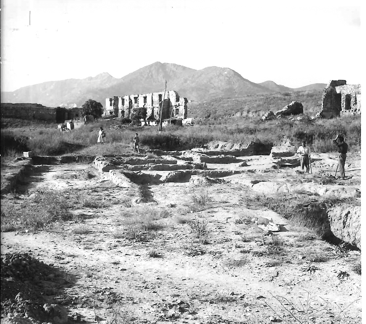
As from the 4th century BCE, Rhode began to mint its own currency. These are silver and bronze issues that follow the usual patterns in the Greek world and use the rose as a symbol. In the 3rd century BCE, Rhode experienced significant economic growth. During this period , it became politically independent, and major urban reforms were initiated. In the upper part of the Santa María hill—under the current church (A)—archaeological research has detected the replacement of the old residential buildings that occupied the space by a large public building, probably a temple. This would have been located on the site now occupied by the church of the Santa María monastery. Unfortunately, the preserved remains are very scarce, due to the construction and renovations that have taken place in the area over more than twenty centuries of history.
At the foot of the hill, to the east, a large, wide north-south wall, built with huge stone blocks (B), was discovered some years ago. Although it was initially thought that it could be part of the wall that would have surrounded and protected the town, other researchers believe that it could be a large public building. One hypothesis, difficult to verify today, is that it is a stoa, the market where much of the colony’s business was carried out and which constituted one of the main civil buildings of Greek settlements.
Source: Naturpas-CRAPA.
To the north of this building, where the Citadel Land Gate (C) is currently located, a very wide wall (made up of two parallel walls) oriented east to west, almost four metres wide in total, was located, which would constitute a section of the town’s wall. If the two described sections belong to a wall, it must be concluded that they belong to different chronological moments, given their different characteristics.
Source: X. Aguelo.
In the 3rd century BCE, a new quarter was built around the port (D). This was located to the east of the hill, in a flatter area, next to the Rec Fondo stream, and is known as the Hellenistic quarter (File 3).
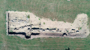
The new quarter was built based on a series of rectilinear streets that crossed at right angles, an urban model that the Greeks called Hippodamian. Although there are some large houses, it is an artisan quarter dedicated to manufacturing products. Among them, the manufacture of tableware pieces (bowls, plates, etc.) stands out, which archaeologists know as black-varnish ceramics of Roses, and which were exported throughout the Western Mediterranean. Some kilns that manufactured these ceramics are still preserved. Other products were also manufactured in the quarter , as evidenced by one of the located kilns dedicated to the manufacture of iron pieces.
Source: MAC-Girona.
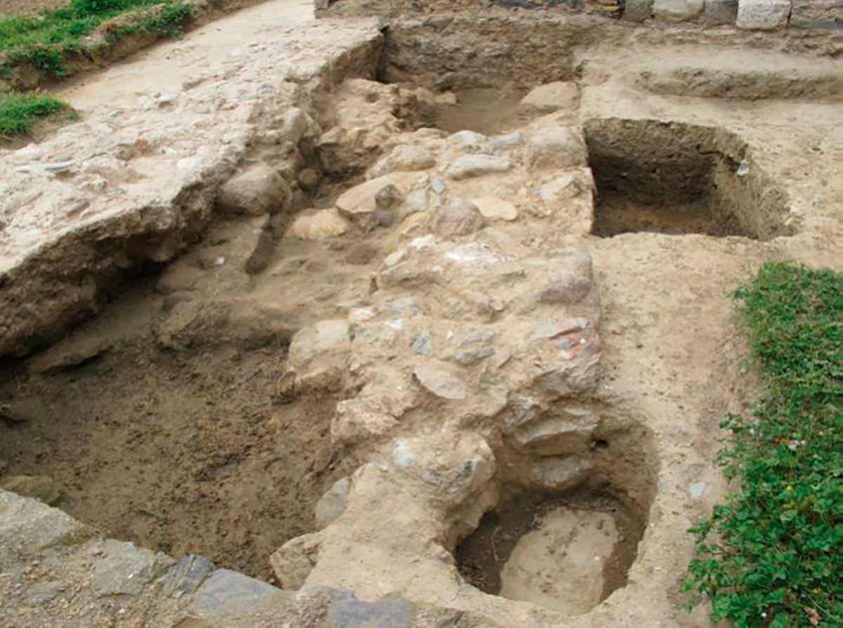
Hardly anything remains of the port, but part of the dock wall is still preserved, built with large stones and which, in Roman times, already useless due to the displacement of the coastline, remained hidden under a large building (File 1).
At the end of the 3rd century BCE, there were two great powers in the Mediterranean that disputed political and commercial power: Rome and Carthage. It seems that Roses mainly traded with areas under Carthaginian influence. When the second war between Rome and Carthage (known as the Punic Wars) occurred, it appears that Roses sided with Carthage, while Empúries allied with the Romans. The Roman victory—at the beginning of the 2nd century BCE—led to the growth in importance of Empúries and the disappearance of the Greek colony of Rhode.
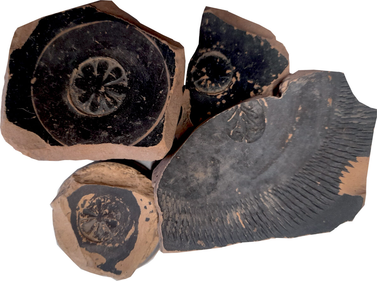
| The Ceramics of Roses
Throughout the 3rd century BCE, in what is known as the Hellenistic Quarter , there were ceramic workshops that manufactured tableware that was exported throughout a large part of the Western Mediterranean, especially the Iberian Peninsula and the south of modern France. The most famous one of these is the workshop of the three radial palmettes . These are pieces covered with a black varnish and decorated on the bottom with palmettes.
|
For further reading
Buscató, L. (1999). La colònia grega de Rhode. Una aproximació al seu origen, evolució i desaparició. Papers de Recerca, 4. Ajuntament de Roses.
Puig, A. M., i Martín, A. (coord.) (2006). La colònia grega de Rhode (Roses, Alt Empordà). Sèrie Monogràfica, 23. MAC-Girona.
Villaronga, L. (2000). Les monedes de plata d’Emporion, Rhode i les seves imitacions. De principis del segle III aC fins a l’arribada dels romans, el 218 aC. Barcelona. https://publicacions.iec.cat/repository/pdf/00000329/00000098.pdf
Vivó, D. (2023). Rhode, la «otra» colònia. Desperta Ferro. Arqueología e Historia, 51, octubre de 2023.