
Did people live in Roses between the 7th and 10th centuries? Surely yes, but probably inland, away or hidden from the coast, since at that time it was a dangerous space, subject to the never-friendly visits of pirates and other possible attackers. What does not seem to have existed—or has not been found so far—was a settlement. However, what probably continued to exist, more or less well preserved, was the small church built in the 4th century.
Source: CRAPA.
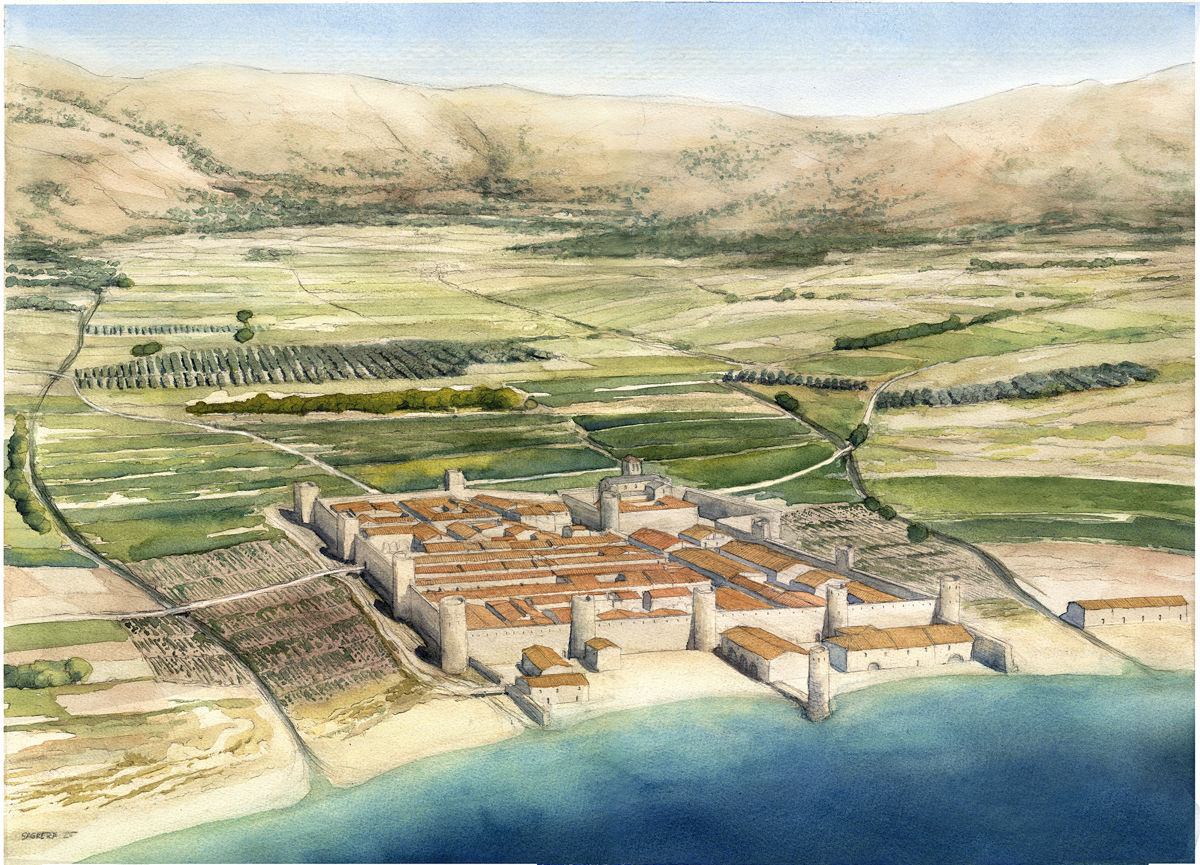
The old Late Roman church still existed, or at least the memory that the upper part of the hill was a sacred space was preserved, as we find in the very foundation of the monastery. Since the 9th century, Roses was part of the County of Empúries. In the 10th century, Count Suñer of Empúries (862–915) decided to build a monastery dedicated to Santa María (File 14) and chose the top of the small hill to erect it, where the Greek temple had been and where the Late Roman church was still preserved, more or less standing.
In the medieval era, it was common for people to make donations (in money or land) to the church. Thus, the monastery gradually became richer, and at the beginning of the 11th century, major reforms were carried out. To begin with, a new church was built (File 15), which is the one we can visit today, but it seems that the entire monastery complex was also remodelled, including the interior courtyard (cloister), the monks’ quarters, and even the walls that protected it (File 16).
It was probably during this era—when a lot of labour was needed, not only to build the new monastery but also to work its lands or provide it with all kinds of products—that the medieval town of Roses was born.
The original nucleus of the new town was built to the west of the monastery, and the houses were distributed around two perpendicular streets that received the significant name of Carrer de la Creu (Cross Street) (File 22). Contrary to popular belief, medieval towns were not the result of disordered urban planning, where everyone built their house more or less wherever they wanted. Instead, the construction of a new town was subject to previous planning, in which the streets were marked, the different blocks of houses were defined, and even the plots were delimited, planning how the different dwellings should be.
Source: J. Sagrera.
Between this first town and the monastery, there was an empty space, where a square was eventually created that was intended to function as a market space and where the parish cemetery was also located, at least in the modern era.
The village grew, especially as from the 12th century. The two streams located to the east and west (Rec Fondo and Riera de la Trencada) limited the growth of the population in these directions. That is why the town extended southward, towards the beach and the port. The neighbourhood located to the south of the foundational town was organised around streets oriented from east to west. Conversely, the part of the town that was built south of the monastery was structured around two long north-south roads that directly communicated the port area with the monastery itself.
Source: J. Sagrera.
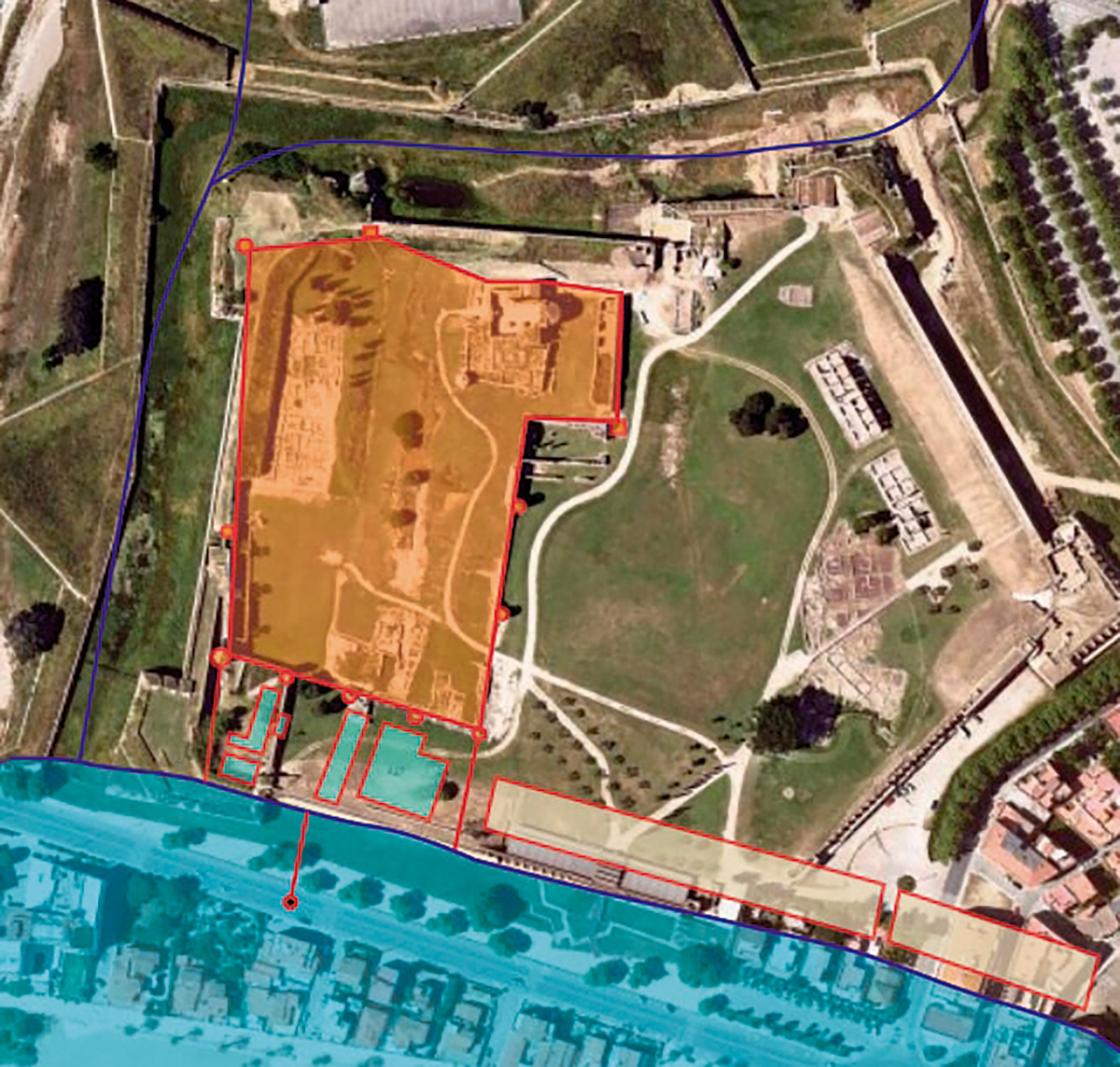
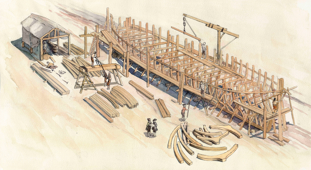
In the beach area, there were two sections that always remained outside the walled enclosure: the port section and the fishermen’s section . Added to the commercial importance of the port in the medieval era was its military importance. Starting in the 11th century, Roses became the main military port of the County of Empúries. This role was reinforced by the construction of dockyards in the port section, an installation intended for the manufacture of galleys, which constituted the main warship of the Catalan county fleets and of the Crown of Aragon.
From at least the mid-14th century, the port had a stone quay, equipped with a defensive tower. This is an exceptional element since most coastal towns did not have genuine quays, so ships anchored a few metres from the coast, and merchandise and crew members were brought to the beach in boats.
Source: CRAPA.
| The Capbreus
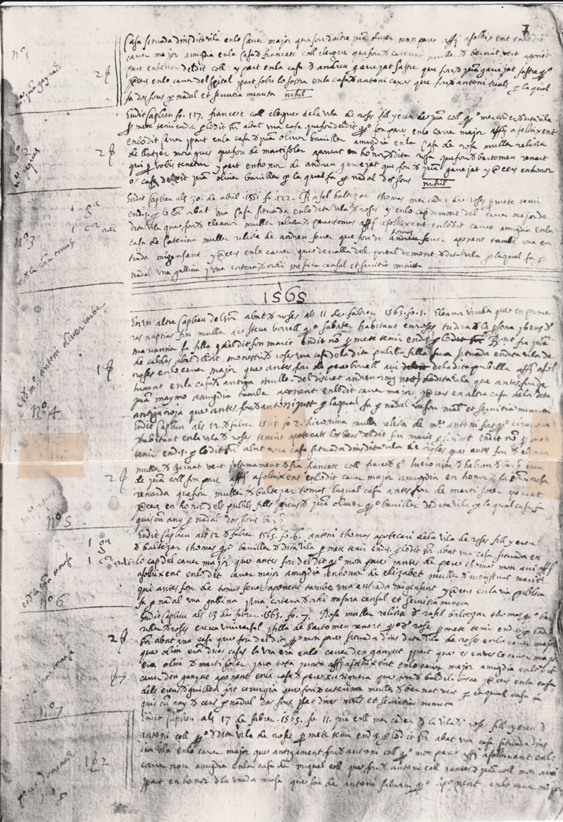
The capbreus were a fiscal document in which the feudal lord recorded the names of all those who had to pay him taxes, either in money or in kind (products, days of work on the lord’s lands, etc.). The capbreus cite the names of the house owners and their profession. By cross-referencing this data with archaeological evidence, we can reconstruct the evolution of a large part of the population in certain periods. As an example, we can see how the house located at the southern end of the Carrer Major in the year 1361 was owned by Guillem Sallzeda. In 1500, the house belonged to the Roig family, a family of merchants, and in 1565 it had passed to Feliu Morera, also a merchant, who married Catalina, the heir of the previous owner, Nicolás Roig. Some of the families cited in the capbreus still exist and live in Roses.
|
For further reading
Burch, J., & Palahí, Ll. (cur.) (2018). El monestir de Santa Maria de Roses. Guies del Patrimoni Cultural de Roses, 1. https://www.documentauniversitaria.media/omp/index.php/crapa/catalog/series/guies
Palahí, Ll., Bouzas, M., & Vivó, J. (2023). Noves excavacions a la Ciutadella de Roses. De la vila medieval a la conversió en espai militar. Annals d’Estudis Empordanesos, 54, 139–156. https://raco.cat/index.php/AnnalsEmpordanesos/article/view/423726
Palahí, Ll., Pujol, M., & Aguelo, X. (2022). Les muralles del monestir de Santa Maria i la vila de Roses a l’edat mitjana. RODIS. Journal of Medieval and Post‑medieval Archaeology, 5, 125–150. https://www.documentauniversitaria.media/rodis/index.php/rodis/article/view/57
Puig, A. M. (2020). La modulació urbana a l’eixample baixmedieval de Roses. El prototip de casa. RODIS. Journal of Medieval and Postmedieval Archaeology, 3, 35–56. https://www.documentauniversitaria.media/rodis/index.php/rodis/article/view/21
Pujol, M. (1997). La vila de Roses (segles XIV‑XVI). Papers de Recerca, 2. Roses.