
To understand the history of Roses, it is essential to know the territory where human settlements were built and the great changes that the landscape has undergone over time.
One of the first things we discover when arriving in Roses is the fact that its great bay is protected from the northern winds—the tramuntana—and the eastern winds—the llevant—which usually blow strongly in the Empordà area. This fact was very useful for ships sailing north in the area and needing to navigate the Cap de Creus, a place known for its rough seas and heavy swells. If they encountered a severe storm, they could take refuge in the bay and wait for the weather to improve. Smaller boats were hauled ashore and laid out on the beach sand for protection, as is still done today on some beaches with fishing boats. Larger ships could anchor in the bay.
Roses was also ideal for provisioning, since a series of small streams provided fresh water for the crews.
This fact has shaped a large part of the history of Roses and has made it an ideal port over time. Not only for commercial ships, but in certain eras, it has been an important port from a military point of view, due to its strategic location, close to the Pyrenees and the French coast.
Another important element is the changes that have taken place in the landscape. It is usually considered that the configuration of the territory and its orography are elements that decisively influence the choice of places to establish human settlements. In few places is this assertion truer than in Roses. The problem is that the environment we see today is very different from the one the Greeks found 2,500 years ago. But not only that, the environment where the Greeks lived in the 4th century BCE was different from the one that existed in the medieval period, and this was not the same as that of the 16th century, when the Citadel was built. Therefore, one of the great challenges that visitors face is understanding and visualising these significant changes that have taken place in the landscape.
The contribution of sand, which the various streams and torrents in the area have been depositing over time, has accumulated sediments and caused a progressive displacement of the coastline towards the south. This, in turn, has also caused new human settlements to progressively shift in that direction, always seeking proximity to the beach. Furthermore, an important part of the surrounding territory was occupied by marshes that have dried up over the centuries, either naturally or, especially , due to human intervention.
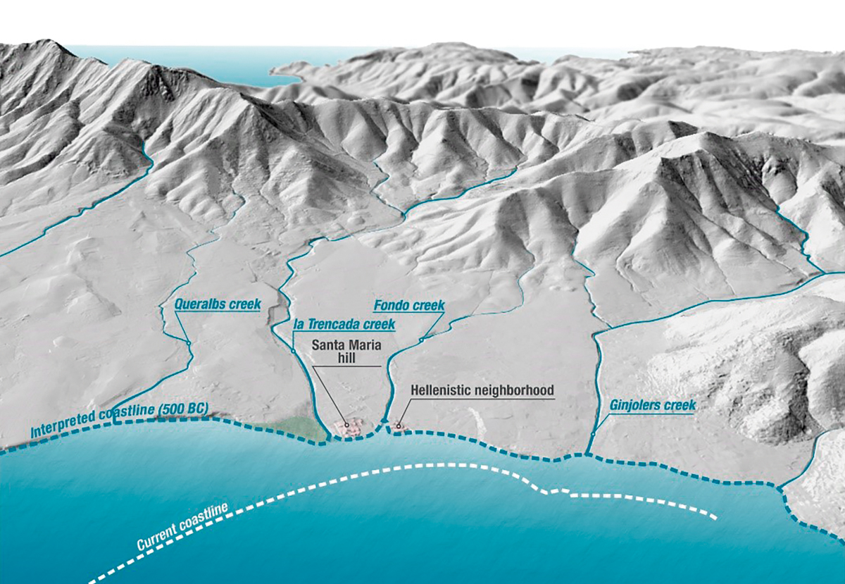
In the 4th century BCE, when a Greek community decided to found a small colony, the landscape was nothing like it is today. The small hillock of Santa María, where the monastery now stands, was at that time an elevation that penetrated slightly into the sea, flanked by two river courses, the Riera de la Trencada to the west and what is known as the Rec Fondo to the east. The shoreline at that time was practically at the foot of the small elevation, about two hundred and fifty metres north of the current position.
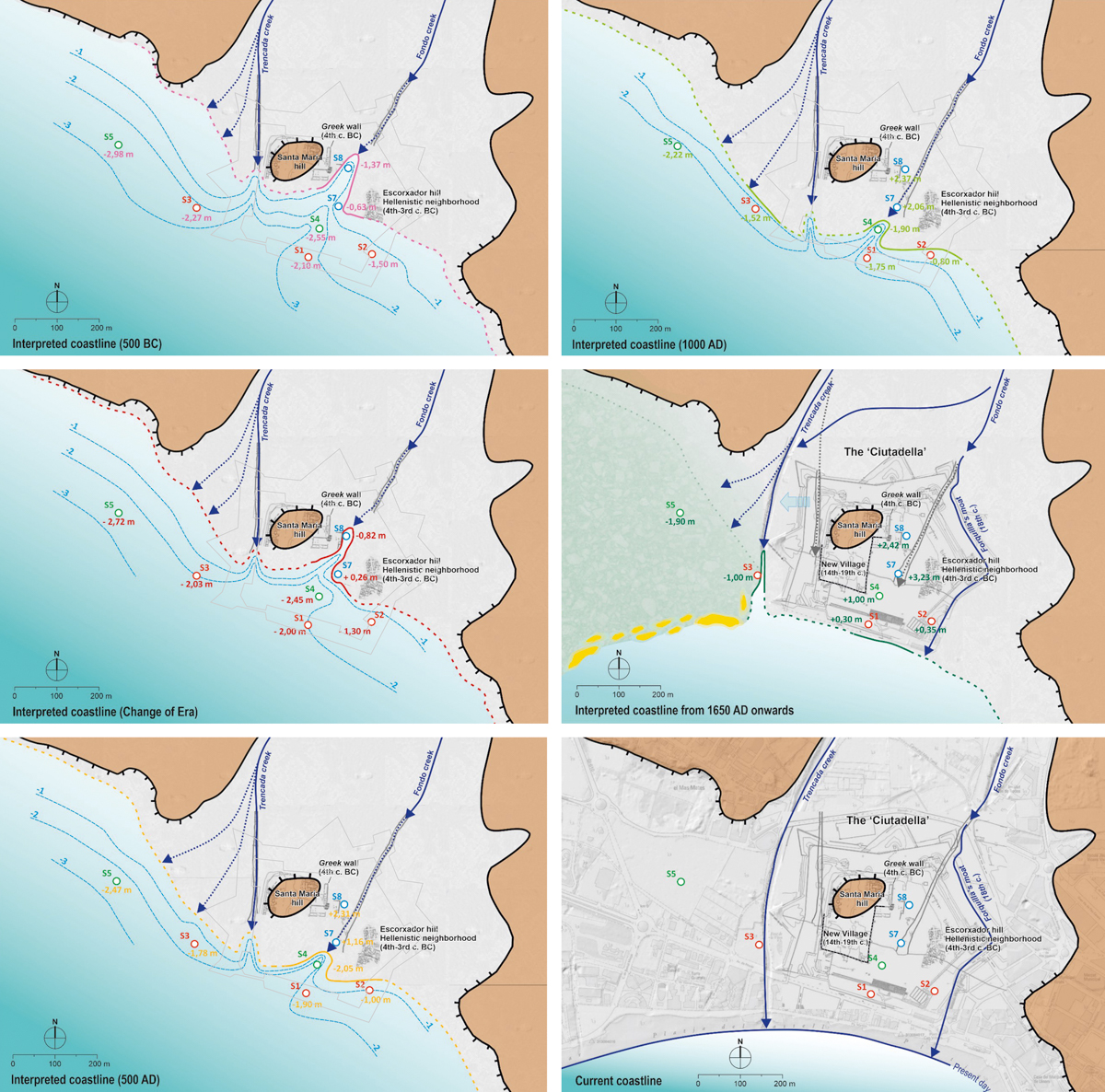
Source: CRAPA-Geoservei.
In Roman times (six centuries later), the coastline had already shifted south and the old dock that the Greeks had built was already useless—separated twenty metres from the water—and ended up covered by an industrial-type building (File 1). But perhaps the clearest example of these changes can be found in the 16th century, when the Citadel fortress was built. Its southern wall was constructed touching the seawater. One only has to glance at the exterior part of this wall to appreciate how the large iron rings are still preserved, attached to the wall, which were moorings for ships. This means that the space where the current access street to Roses ( Rhode Avenue) is located, was water in the 16th century.
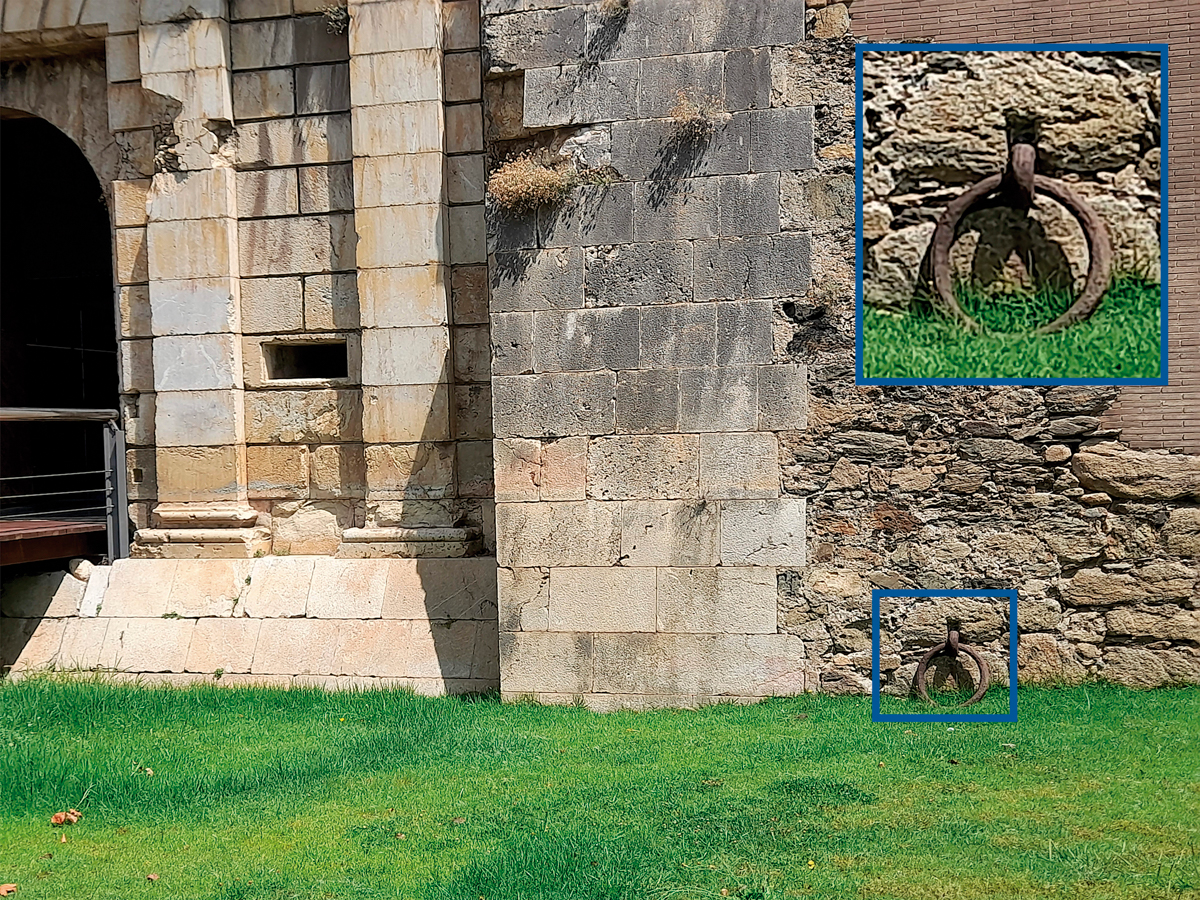
Source: CRAPA.
There is a final element that has conditioned the history of the settlement in Roses. The entire area located west of the current Citadel fortress was occupied by an extensive area of wetlands and marshes that made inland-penetration difficult. This made Roses an ideal place to arrive by sea and anchor ships; in fact, it was much more suitable than the coast of neighbouring Empúries, located a few kilometres to the south. However, communication with the interior territory, necessary to establish ties and trade routes towards the Empordà plain and the plain of Girona, was much more complicated.
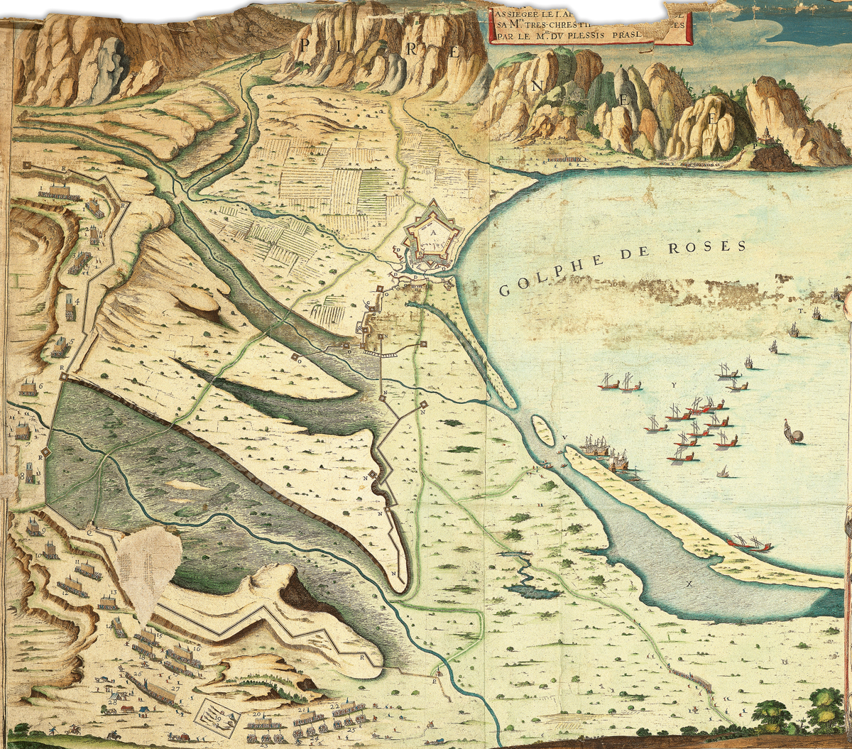
Source: Roses Municipal Archive.
| Streams that Move
The construction of the modern Citadel fortress involved a displacement of the two streams that, until then, had circulated on both sides of the Santa María hill. The Riera de la Trencada was diverted further west, outside the new moat. The Rec Fondo was also displaced and finally, blinded (filled in) because if it hadn’t been, it would have run through the centre of the fortification.
|
For further reading
Bouzas, M., Burch, J., Julià, R., Palahí, Ll., Pons, P., & Solà, I. (2023). Changes and transformations on the coast using the example of Roses (Alt Empordà, Catalonia). Land, 12. https://www.mdpi.com/2073-445X/12/12/2104
Puig, A. M. (2012). The issues surrounding the peri-urban environment of Rhode. In C. Belarte & R. Plana (eds.), El paisatge periurbà a la Mediterrània occidental durant la protohistòria i l’antiguitat (pp. 83–98). https://recercat.cat/handle/2072/231093#page=1